STEP BY STEP DEEP CONVECTION NOWCASTING
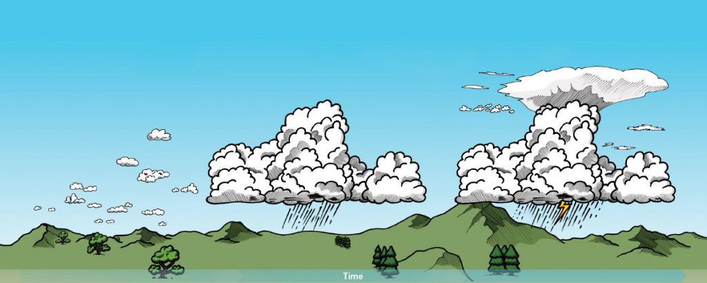
1. Pre-Convective Environment
Refers to the 4-D thermodynamic and wind field present before the convective initiation occurs.
2. Convective Initiation
Refers to the process where an existing cumulus cloud begins rapid vertical growth.
3. Mature Convective Storm
Refers to the presence of convective clouds with tops at or above their local equilibrium level.
Useful tools:
NWP data, Radiosonde and aircraft measurements
MSG GII/RII Product – instability & moisture
iSHAI Products – instability & moisture
HRW Product – wind fields
METOP/IASI level2 – temp & moisture vert. profiles
Useful tools:
Radar, lightning data
Cloud Type
Cloud Top Temperature and Height
Cloud Microphysics
Convection Initiation
Optimal Cloud Analysis – demonstrational
Useful tools:
Radar, lightning data
RDT Product – storm tracking
Precipitating Clouds
CRR Product – precipitation
NEFODINA
Overshooting Top Detection
MSG Sandwich Product (HRV+IR10.8 enhanced)
Lightning Density
Suitable RGB Imagery for Convection monitoring at different stages of development (EUMeTrain Quick Guides)
Suitable RGB Imagery for providing visual information on atmospheric water vapour content in cloud-free areas (EUMeTrain Quick Guides)
CWG satellite nowcasting guidance version 2018-2. Cloud photos source: WMO International Cloud Atlas, Copyright Stephen Burt and Matthew Clark. Design specification for this webpage: Stephen Killick, EUMETSAT.Printable overview poster [pdf]
This is a service from the EUMETSAT Convection Working Group (CWG). Contact for feedback: EUMETSAT Training