
(MSG) “Sandwich” Image Products
Operationally produced by National Meteorological Services
Application:
Operational monitoring of characteristics of convective storm tops and various storm-top features, related to storm intensity and potential severity. The sandwich image products consist of two image layers which are merged together, using various blending functions, such as “multiply” or “linear burn”. The bottom layer is any high-resolution visible band, while the upper layer can be any colorized or RGB image product. The most commonly used combination is a sandwich product of visible band (e.g. HRV) with a color-enhanced IR brightness temperature image, shown right.
Limitations:
Efficient only when used for local to regional scale high resolution images, marginally usable in global imagery. Most efficient for lower elevations of the Sun.
Pros and cons:
✓ Brings together information about cloud-top morphology (from visible bands) with other characteristics of clouds, available from color-enhanced or RGB images.
X Available during daytime only.
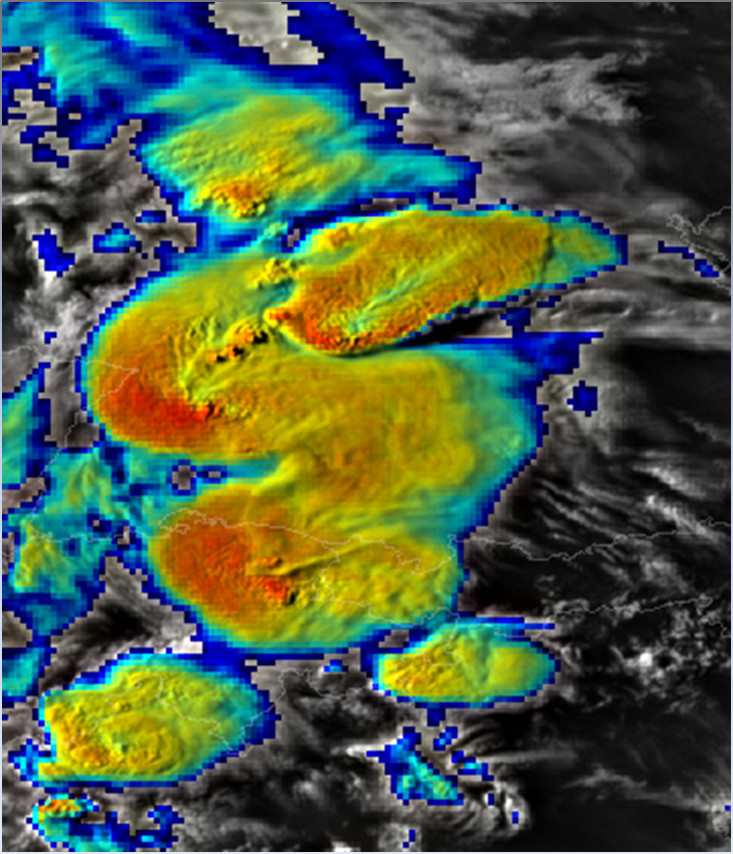
Example of MSG SEVIRI-based sandwich product – combination of HRV band with color-enhanced IR10.8 brightness temperature image. Germany, 12 July 2011, 1740 UTC.
Accessibility and Dissemination:
Mostly on national level, distributed by various national weather services (typically for their internal use only).
Additional Information:
Sandwich Product at the CWG website (2009)
A-Train Observations … (Atmos. Research 2012 paper)
EUMETSAT 2012 conference
Convective Storms BlogSpot (2013)
prepared by Martin Setvák, CHMI, v.2017